MapPath : GPS Tracking, Measure 1.9
Device: iOS Universal
Category: Navigation
Price: $.99, Version: 1.8 -> 1.9 (iTunes)
 Description:
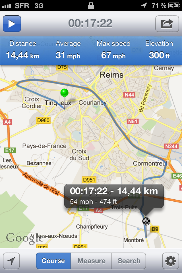
"MapPath" is an easy-to-use app allowing you to record your trips. MapPath displays your track, your position and live information such as your speed, altitude or average speed. "MapPath" is also an utility that allows you to measure distances, surface areas and perimeters by dragging pins (points) on the map.And at any time, share, import and export tracks and measures. Features :- record your run: time, distance, altitude, speed, average speed- pause and resume recording as needed- display your trail on map- display charts of your altitude, speed and pace- location and heading tracking- measure distances, surface areas and perimeters using pins (points) on the map- add point to your measure by taping and holding the map- gps accuracy options- system of units options- import (mail, safari or other app) and export (mail, other app) your tracks and measures from and to KML format - share summary of your track or measure by mail, facebook and twitter- share by mail your tracks and measures to other device- support for portrait and landscape on both iPhone (iPod Touch) and iPad- support for retina display on both iPhone 4(S) and new iPadNote that continued use of GPS running in the background can dramatically decrease battery life.If you have any problem, suggestion or if you want to contribute to MapPath by translating it in your language, please feel free to contact me at contact@julienroze.fr
What's New
- Export tracks to GPX format (mail / open in...) - Import GPX file (mail, safari, other app)- Export tracks data to CSV file (Excel/Numbers)- New tools menu
MapPath : GPS Tracking, Measure